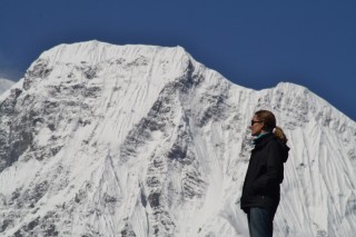
 When we left for our trip around the world, we didn’t have a fixed itinerary, rather a whole bunch of ideas. Going hiking in the Himalayas was one of them. However, it wasn’t until we met Dustin, an American traveller, on a cross-border train from Mongolia into China, that we first heard about the Annapurna Circuit. After listening to his glowing accounts of this long-distance trek in central Nepal, the idea was born that night in July, while we rattled through the Gobi desert, that the Annapurna Circuit sounded like a challenge we would love to take on.
Fast forward: almost ten months later, we arrive in Kathmandu. The hiking seasons in Nepal are limited due to harsh winters and the monsoon during the summer, so we carefully timed our visit here. We spend a week in the capital, organising our visa for the onward trip to India, upgrading some of our equipment and getting the permits for the Annapurna Conservation Area. Finally, we take a local bus directly to Besishahar, the town where the Annapurna Circuit officially begins: 180km from Kathmandu, but it takes eight hours to cover this distance. Welcome to roads in Nepal – you are better off walking, really.
Well, walking is what we do for the next three weeks. When we put our backpacks on in Besishahar – despite our efforts to take only the most necessary items they still feel very heavy – there is a real sense that this is where the adventure begins. About 220 km ahead of us, around the Annapurna massif, with one of the world’s highest passes, Thorung La at 5430m, to be crossed along the way. We take a deep breath and start hiking, excited by the challenge ahead of us.
The Annapurna Circuit is a so called tea house trek – you hike from village to village, where you can stay overnight and eat in small guest houses. The lodges charge next to nothing (or somethings really nothing)for their simple rooms, but expect you to eat there. While the food is overpriced by Nepalese standards, it’s still extremly cheap if you compare what you pay these days at huts in the Alps. And it’s a pleasant surprise that most lodges have hot (or at least lukewarm) solar showers – a real treat at the end of a long day of hiking. And the incredible views you have from most lodges come for free and in abundance.

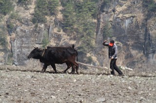
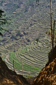
 And so we walk, and walk, and walk. Through terraced landscapes, narrow gorges, along horizontal rockfaces, over countless suspension bridges crossing the river, through bamboo forests and groves of blooming rhododendron, and up steep stone staircases. Every now and then, we have to give way to traffic on the trail – herdes of donkeys or mules carrying goods up or down the valley. We watch the local people go about their daily business – ploughing their fields on steep terraces with buffalos, making baskets out of cut and soaked strips of bamboo, spinning yak wool. Many locals changed their attention to the tourist trail that passes through their villages and are now running lodges, restaurants or small kiosks. Overall many of the villages retain an authentic charme with their stone houses, mani walls with inscribed stone tablets at the entrance, and scenic views. In the evenings, we meet fellow trekkers in the lodges, and stories are exchanged over Dhal Bhat, the Nepali national dish – rice with lentils. A few days into the trek, we start to know already the people that began around the same time as us.
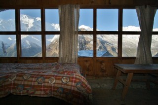
As we reach higher altitudes (we started out at an elevation of only 800m in Besishahar), the vegetation changes, and the views become more dramatic as the first eighttousanders move into sight. Manaslu (8156m) is the first one of them – impressive and awe-inspiring. We are really lucky with the weather, pretty much every single morning we wake up to blue cloudless skies, sunshine and amazing mountain views. Only in the afternoon the clouds move in, masking the high peaks. So sometimes we arrive at a lodge, and only the next morning see yet another peak towering right over us. With the altitude comes the cold. Above 3000m or so it gets icy as soon as the sun goes down. The rooms are unheated, and insulation here is not really up to European standards – with creaks around windows and in walls. So while our sleeping bags were sufficient at the lower elevations, we start to use the extra thick blankets the lodges provide as an extra line of defense against the cold. Another trick to warm the room a bit is to light candles. This kills two birds with one stone, as often there is no electricty. Plus, it’s really romantic. Snuggling up really close to each other is anyway the best way to keep warm when it’s so cold in the room that you can see your breath.
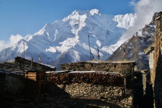
One of our favourite sections of the trek was the part between Upper Pisang and Ngawal. After a steep climb up to an old Buddhist temple with the most incredible view of Annapurna II, we decide to find a more direct trail to the next village that is indicated in our map. A Dutch couple that we met the evening before joins us. As the four off us set out to find the alternative trail, we eventually find one that heads in the right direction. It climbs endlessly, and after a while doubts arise whether this is indeed the right direction. Eventually, two Nepalese men come down, and are totally surprised to meet us. They told us that they just returned from leading a group of climbers to Pisang Base Camp (Pisang Peak at 6091m is covered in glaciers). At this point, the Dutch guys decide to turn around and return to the last village. Mario and I decide to continue, we feel there might still be a chance that this is the dotted little trail on the map and are not yet ready to give up. Crashing thunder ten minutes later announces deteriorating weather and soon it starts snowing. Now we, too, wonder whether this is the way to go. We decide to set ourselves a turnaround time. If we cannot see the village we are aiming for by 4pm, we’ll also go back and hopefully reach Upper Pisang before it gets dark (we learned our lesson from a hike we did in Mongolia where we got stuck on a mountain at night, but that’s a different story). So we hike hurriedly along a clear but obviously not very frequented trail: the only traces we can make out in the snowy parts are yak footprints. Funnily, on this deserted section off the main Around-Annapurna trail, we see more wildlife than in the entire three weeks of the trek – Himalayan pheasants, foxes, something that looked like a wolf and also a bunch of deer. Eventually, behind a ridge, we spot the village we are looking for. The tension, partly created by the looming thunderstorm, dissolves instantly, and we are excited to have found this way to Ghyaru that is apparently unknow even to some of the guides. By now, we have probably climbed above 4000m, and we descend to Ghyaru at 3780m. By the time we reach the lodge, there is a blanket of snow covering the ground. It never felt so good to reach a lodge on the whole trek. The older French couples with their guides and porters, that have come the main trail and already sit in the lodge for hours, look up from their cups of hot chocolate in surprise as we enter at 5pm, covered in snow. Well, we loved our little detour from the well-trodden path.
Ghyaru rewards us the next morning with stunning mountain views, and we set out towards Manang, where we join the main trail again. As the last bigger settlement before the Thorung-La pass, Manang presents itself as if it were a real city. It even has a cinema, which screens movies like ‚Seven Years in Tibet‘ or ‚Into thin Air‘. We opt to see the latter, and the friendly ticket seller leads us through the snow to the screening room. It turns out the be a stable that is now outfitted with a few wooden benches draped with yak skins, a screen and a a projector. An oven fired with animal dung tries to fight the freezing temperatures, though not very successfully. Our 200 rupee movie ticket, less than 2 Euro, includes a cup of hot tea and popcorn – eat that CinemaXX. And then, while trying to stay warm and with the snow falling thick and fast outside, we watch the 1996 drama on Everest unfold, where eight people died in a blizzard before reaching their camp at 7900m. The cold in our hotel did not feel so bad that evening.
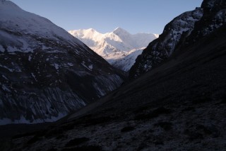

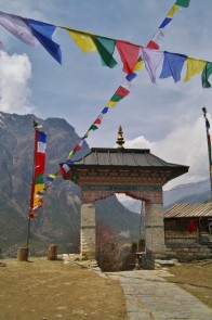
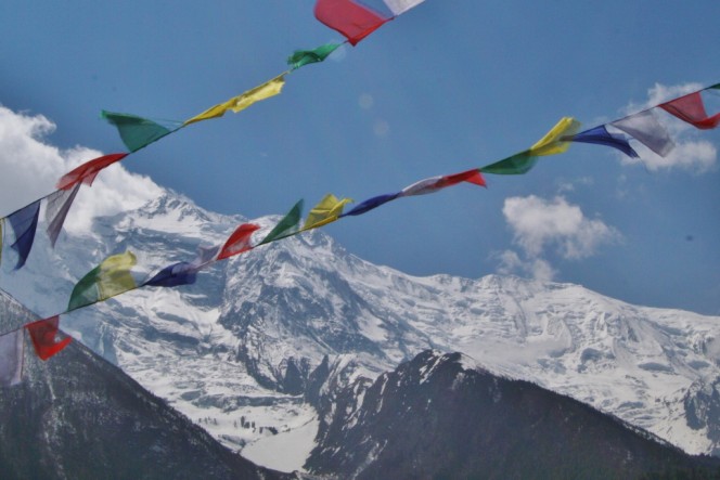
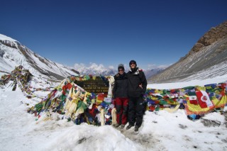 Thorung-La, the biggest challenge of the trail. Having spent now two nights in a row above 3500m, we feel well acclimatized and hike straight from Manang to Thorung Phedi, the tiny settlement at the end of the Thorung valley at 4500m. At altitude, it’s hard to sleep well. Plus from 3am, we hear some overambitious people get ready and leave the lodge for the big day. The cold before sunrise is crazy though, and after having seen that movie about Everest yesterday, I can’t even imagine what it must be like even higher up. We put on all the clothes we carry with us, some hot tea and porridge for breakfast, and then we’re also off to cross the pass. We have to climb 900m, from 4500 to 5400m, and with the oxygen levels noticeably lower up here it is hard work and slow. Even things like drinking a few sips in a row cause you to get out of breath. It’s a crazy feeling. I have flashbacks of our climb up Hyuana Potosi (6088m) in the Bolivian Andes five years ago. Thankfully there is no technical climbing involved this time, just following the trail across snowfields, higher and higher up. The panoramas are stunning here, and we feel eye-in-eye with the big mountains. At last the prayer flags marking the pass come into sight. When we finally reach them, it’s an overwhelming moment: the views, the feeling of achievement, the physical exhaustion. The obligatory victory photos are taken at the plaque that marks the pass, and we allow ourselves an hour-long break and have a picnic in the sun, with views to both sides of the mountain. Then, we begin the descent on the other side. Several hours of knee-destroying steep paths until we finally reach Muktinath at 3710m, a Hindu pilgrimage site and the first village in the Kaligandaki Valley.

Since a few years, Muktinath is connected by a gravel road to the popular hot spring city of Tatopani from where it continues to Pokhara and Kathmandu. Many people on the trail appear to be complaining about this road (and also the one that is being built at the beginning of the trail) – how it destroys the hiking trails, how the jeeps almost run you over and that it’s just not what it used to be. There is even a German journalist from „Bayerischer Rundfunk“ in Muktinath doing a documentary on the impact of the road on the Annapurna Circuit. We weren’t here before the road was built, but what we find remarkable is that the people complaining loudest about the road are the first ones to get on a jeep in Muktinath and drive on said road to Tatopani. The dusty road and reckless drivers seem a good excuse to end the trek a hundred kilometers early. And who are we anyway to deny the people in remote villages a bus into their district capital just because we prefer scenic hiking trails for our holidays.
In any case, we decide to walk. All the way. There are parts where we have to walk on the road, and admittedly they aren’t the nicest sections, but for the most part there are well-marked little trails on the other side of the Kaligandaki river, so we hike unperturbed by the road, with great views of Dhaulagiri (8167m) and its icefall, through beautiful villages with dying lodges, because all the tourists these days sit on the jeeps or busses bypassing them. The three days it takes us from Muktinath to Tatopani are the quietest on the whole trek. We only meet two other trekkers on the trail, and a really nice Austrian-Polish couple in a lodge, who are hiking in the other direction. They tell us about a lesser-known view point named Koprah they had hiked to, and mark it on our map. So by the time we reach Tatopani a new plan has formed in our heads. And while we soak our muscles in the hot springs, we decide that 11 days of hiking is just not enough. The trekking here is addictive, fascinating, beautiful – so we decide to continue via the Koprah view point towards Annapurna Base Camp. We’ve heard it’s amazing, and so far personal recommendations from people have worked out better than any guidebook. On that note, thank you Dustin, for bringing the Annapurna Circuit to our attention, that night in Mongolia.




5 Responses to Around Annapurna